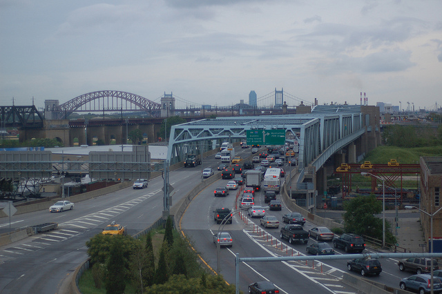
Road Recovery Ratio
Let’s perform an experiment. Some people like to judge public transportation investments based on their farebox recovery ratio or the percentage of operating costs paid by passengers as opposed to subsidies or other revenue. The naive assumption is if a public transportation system has a high ratio, it is a good system. However, fairbox recovery ratios may be low because of other priorities such as providing essential transportation services to low income people or maintaining service late into the night when ridership is lower. In this experiment, let’s do the same for roads. (A couple caveats: 1. This is unfair because fairbox recovery ratios only include operating costs and we will look at road construction costs and 2. Similar to other priorities for public transportation, roads may be "unprofitable" but still provide other benefits like a new carpool lane for express buses.)

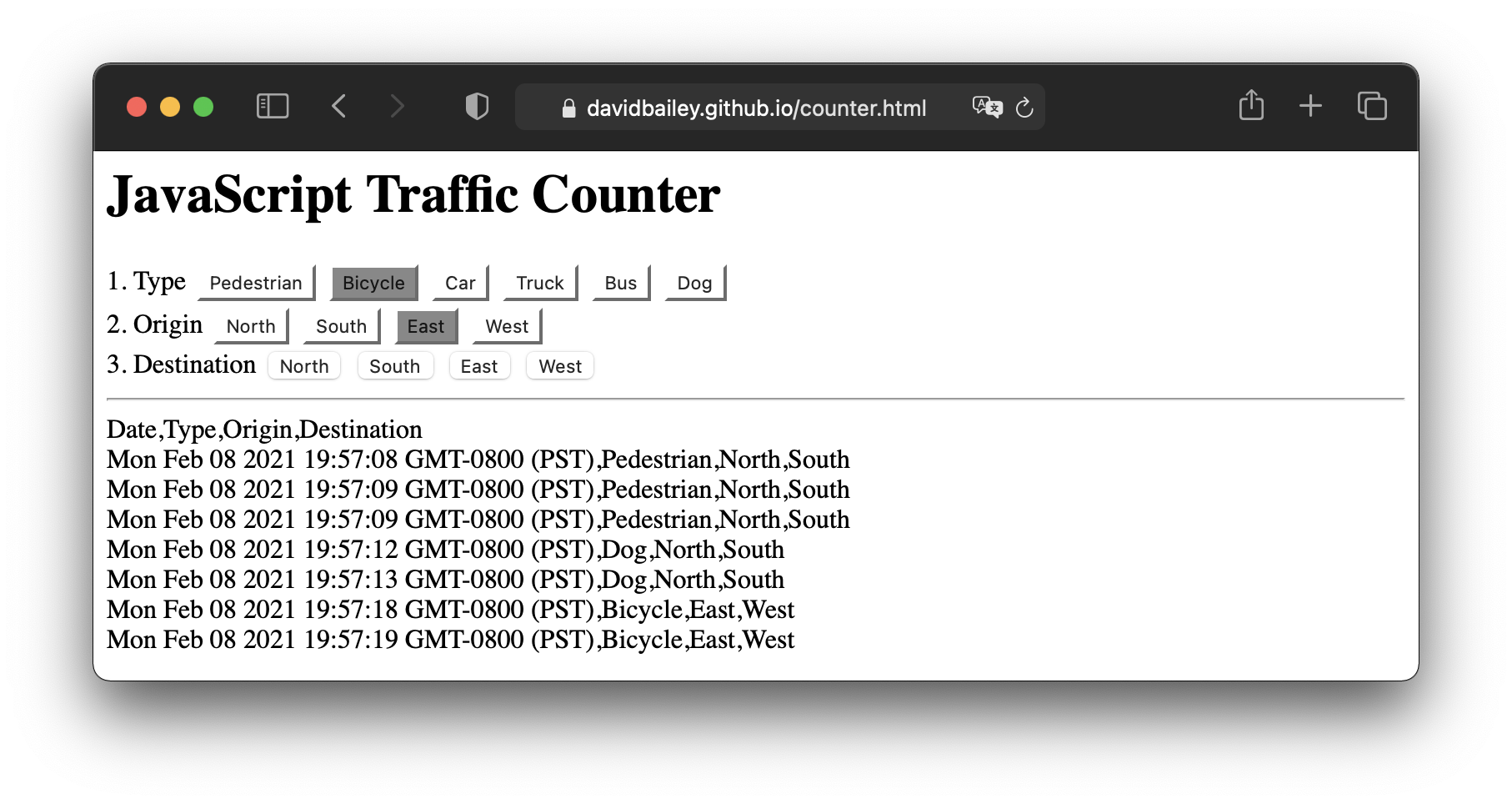
JavaScript Traffic Counter
Commercial Traffic Counters (e.g. Diamond Traffic Products, MetroCount, Traffic Counter Store) are expensive and complicated. For traffic counting at low volume intersections, the JavaScript Traffic Counter is the perfect solution. Simply select Pedestrian, Bicycle, Car, Truck, Bus, or Dog. Then select the approach and exit directions and the JavaScript Traffic Counter records your entry. The CSV table is easily copied and saved for analysis. Use JavaScript Traffic Counter from your laptop or phone.
Visualizing Public Transportation Speeds with Python
When people choose between driving and public transportation for urban trips, travel time (and public transportation frequency) is the most influential factor in their decision. Here we use Python to evaluate public transportation timetable speed between stops to look for slow spots.
Creating a Four-step Transportation Model in Python
A four-step transportation model predicts the traffic load on a network given data about a region. These models are used to evaluate the impacts of land-use and transportation projects. In this example, we will create a model representing California as if it acted as a city.
An Open Letter to the El Camino College Board of Trustees

Over the past two months I have spent several days studying the cycling conditions at El Camino College. While offering affordable parking for staff and students is important for removing financial barriers preventing students from getting to El Camino, I believe you should also dedicate resources to improving cycling at and around the college. Many students cannot afford a car, would rather avoid the expense of driving to school, or enjoy the health benefits of cycling. However, only a small percentage of staff and students cycle to El Camino because of the poor conditions at and around the college. Also, as I am sure you are well aware, constructing parking structures is expensive for the district. Less money could be spent making cycling safer and more convenient for staff and students therefore reducing the need for parking. Below are my initial impressions on the current conditions and potential short-term and long-term improvements. Thank you for your time and consideration.
– David Bailey
Our Traffic Laws Are Not Designed for Bikes
Our streets are often not designed for bikes either. Traffic engineers design right and left turn lanes to allow turning vehicles to queue and wait for breaks in conflicting traffic without impacting traffic. After discussing left turns in my last article, let's look at right turns. The configuration in the picture below is common.
The bike lanes end to make room for right turn lanes and restart after the intersection. Ironically the intersection is where cyclists need good bike infrastructure the most. However, we can improve the situation for cyclists without rebuilding every intersection by allowing bicycles to travel straight through right then lanes. Currently bicycles are required to merge into the straight lane, where traffic is often traveling much faster than the bicycle can, and then merge back into the bike lane. This endangers cyclists and places the responsibility on them for traveling straight. Instead, the responsibility should be on right turning vehicles to safely merge into the turn lane. Many cyclists currently ride this way because of the safety benefits. However, this behavior is illegal according to California MVC 21461.
Left Turns
The US likes center turn lanes. They provide median space to help reduce head-on collisions, and they allow for left turning vehicles to move out of the way of through traffic when waiting for a break in oncoming traffic. However, these lanes use quite a bit of road space because they are rarely used and they encourage speeding by widening the perceived road space. Narrower raised medians or center running light rail tracks can provide the same safety benefits with better use of space.
In the case of raised medians, a narrower median often allows for a bike lane on either side of the road. This 'lane diet' is similar to a road diet. In the case of light rail tracks, it is common for cities to prohibit left turns across light rail tracks to prevent car-train crashes. For example, Santa Monica prohibits left turns across Expo Line tracks on Colorado Avenue. This configuration requires drivers to travel over a mile before being able to turn. Many drivers ignore these restrictions and turn in front of trains. Sometimes this causes train-car collisions. An alternate configuration that allows left turns at all intersections is to create a new, exclusive signal phase for trains and parallel pedestrians. This configuration, popular in Munich, Germany, provides a safer intersection because all vehicle traffic is required to stop for the train. Also, the width of the tracks provides a space for a now-legal left turning vehicle to wait for a break in oncoming traffic without disrupting through traffic.
Last, I must note that some fire departments may raise concerns about this configuration because they use center turn lanes when responding to emergencies. However I hope these safety conscious departments would appreciate the increased safety benefits of this configuration.
People Versus Transportation People
| What People Think | What Transportation People Think |
|---|---|
| Adding lanes will reduce traffic congestion. | Adding lanes will induce more people to drive. Traffic congestion will stay the same. |
| Removing lanes will increase traffic congestion. | Removing lanes will cause people use other routes, shift modes, shift destinations, change their schedule, or not take the trip. |
| Removing freeways will increase traffic congestion. | Removing freeways will cause people to use other routes, shift modes, shift destinations, change their schedule, or not take the trip. |
| Road diets increase traffic congestion. | Road diets reduce speeding and make the road safer for all users. They also increase the number of walkers and cyclists and can reduce congestion caused by turning vehicles if a turning lane is added. |
Autonomous Bicycles
It goes without saying that people are looking forward to autonomous cars. However, ever since seeing a class on autonomous bicycles at TUM, I have been thinking about how autonomous electric bicycles, not cars, could have a greater impact on the next few decades. Here are my reasons why.
Rethinking Landside at LAX
Landside access to Los Angeles International Airport (LAX) is notorious for traffic congestion. To improve landside access, the airport has recently completed several projects such as adding additional traffic lanes and is embarking on new projects such as a people mover in the $5.5-billion Landside Access Modernization Program (LAMP). Here, I suggest another cost-effective project.
Santa Monica Bay Ferry Service
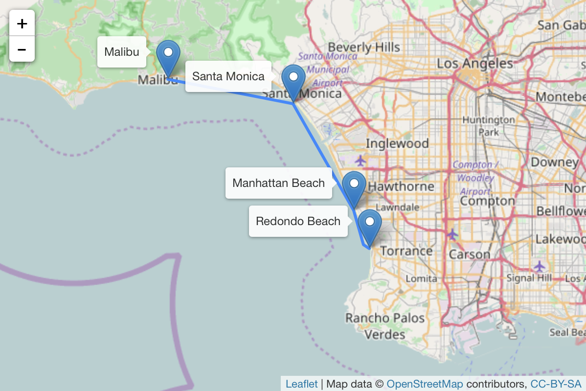
The San Francisco Bay Area just added another ferry to their growing system. In Southern California, a high-speed ferry service linking existing piers around the Santa Monica Bay would provide fast and comfortable service between beach cities for commuters, tourists, and locals. The beach cities of Los Angeles County are primarly connected only by Pacific Coast Highway which is frequency congested during rush hour traffic. Additionally, these areas are lacking with quality public transportation connections. A ferry service would provide an alternative route along the Santa Monica bay linking residents of Malibu and the South Bay with a 30 minute ride to jobs in Santa Monica. Additionally, the coastal areas of the county are some of the most popular with tourists attracted to the beaches. Both commuters and tourists are often willing to pay a premium for fast and comfortable service.
A Comparison of Rail Transportation in Munich and Los Angeles
A comparison of the number of lines, number of stations, system length, daily ridership, and best frequency between subways and light rail, suburban rail, regional trains, and long distance trains in Munich and Los Angeles
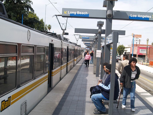
Integrated Ticketing in Southern California
Eight years ago, the Los Angeles Metro introduced TAP cards, wallet-sized RFID cards that can store passes or cash for use on public transportation. TAP cards are similar to Clipper Card in the San Francisco Bay Area or Oyster Card in London. Tap cards are now accepted by 24 public transportation providers in Southern California.
Tap cards greatly simplified transactions for riders and streamlined operations for providers. Southern California should now take the next leap forward and introduce integrated ticketing. Integrated ticketing allows travelers to use one ticket across multiple transportation providers. This method allows riders to choose whichever provider they prefer while not having to pay double. Riders pay for a trip from a to b independent of the provider. For example, riders have a choice of provider from Santa Monica to Downtown Los Angeles. They can take the Expo Lind (Metro), a Metro bus, or the Santa Monica Big Blue Bus. However, these services cost different amounts and riders with a monthly pass from one provider cannot use it on another provider. Also, riders who chose a Metro train or bus get free transfers once they arrive in Downtown Los Angeles, but riders of Big Blue Bus do not. With integrated ticketing, riders can choose either provider for the trip and get the same free transfer options.
FlyAway on the Blue Line
Metro is currently evaluating short-term and long-term improvements to the Blue Line including express service between Long Beach and Downtown Los Angeles, signal optimization, grade separations, and "the feasibility for a full grade separation and/or station relocation including additional parking at Wardlow Station." While these are all great ideas, I propose that the improvements to Wardlow Station should also study a relocation of the Downtown Long Beach FlyAway service to Wardlow Station.
Dodger Stadium Aerial Tramway
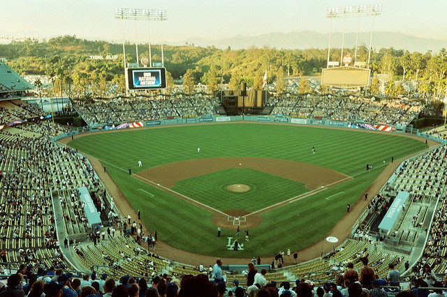
Traffic, parking, and Dodgers: three hallmarks of Los Angeles. How can we address the first two to make a Dodger's game better? Lots of folks have suggested public transit to Dodger Stadium. One of the more reasonable suggestions is an aerial tram between the Gold Line and Dodger Stadium. Let's see how the numbers stack up agains two similar, recently constructed aerial trams, the Portland Aerial Tram to Oregon Health & Science University and the Emirates Air Line in London. Obviously, the Dodger's airline sponsor, United, should buy naming rights to the United Air Line.
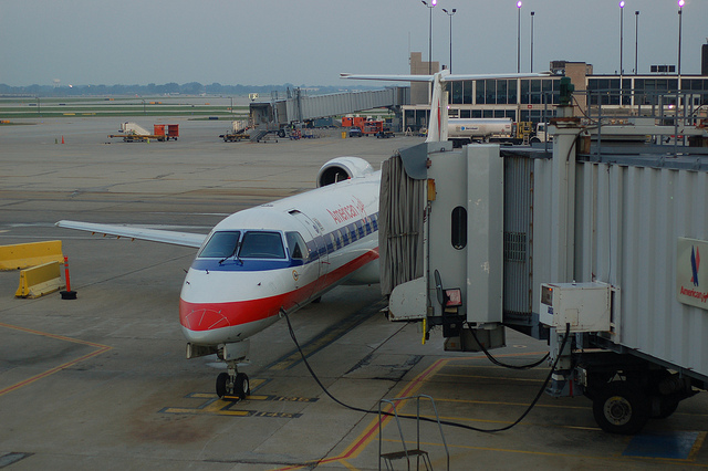
Flying for 1/3 the Price on Delta
Want to get from Albuquerque to Atlanta on the cheap? Don't buy a ticket from ABQ to ATL; get one to CLT (Charlotte). The flight to Charlotte is $212, but a ticket to Atlanta costs $601. The New York Times reported on this phenomenon a while back, but this is the first time I've seen such a drastic difference in fares myself. Buying the ticket with an extra leg to Charlotte results in a 65% savings! Digging deeper into the fares, the trip to Atlanta has the code M while the trip to Charlotte has the code U on both legs. The Fare Chart at cwsi.net/delta lists both codes as discounted coach fares.
Hotels Need to Offer Rental Bikes
What's the first thing most travelers do when they arrive at their destination? Rent a car and drive to the hotel. Most cities require a car to get around. However, these same cities can usually be navigated by bike. But where do you get the bike? Bike shops often rent bikes, but who knows where they are? It's hard to bring a bike with you on a plane. Why not rent a bike from the hotel? Wouldn't it be great to arrive in a new city, take a courtesy shuttle to a hotel, and then jam around on 2 wheels? Exploring a new city by bike allows you to see everything. There's also no parking worries or charges. You don't have to worry about traffic. You can take your newly rented bike on public transit. It'd be cheap for the hotel, and cheap for the guests. Hotels need to offer rental bikes.
Over-metering Congested Freeways Will Increase Capacity
Every day at 5:00 PM everyone in LA knows what traffic on the 10 is going to be like. Awful. Every city has these freeways. They're the roads everyone takes to get home from work. As a side note, traffic at 5 is worse than traffic in the morning because people arrive at work at different times, but most leave around 5. Also, many more people do things after work (get dinner, shop, meet friends) than before work. With everyone leaving Santa Monica at 5, how can we improve things? Over-metered freeways.
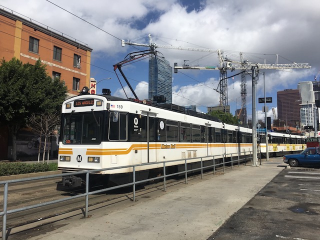
LA Metro Blue Line - Great Termini and a Little Slow
A few weeks back I took a Metro Blue Line train from Los Angeles to Long Beach. This is what I think of the line.
LA Public Transit Works OK
Today I decided to take public transportation from the airport to USC. Although I've been on a bus before in LA, this was my first time alone. Here's how it went.
Amtrak is Awful
This winter I decided to take the Amtrak Southwest Chief from Los Angeles to Albuquerque. I thought it would be fun, interesting, and be a little greener than flying. The train leaves Los Angeles nightly at 6:45 and is scheduled to arrive Albuquerque at 12:12 the next day. However, the word on the street is that Amtrak trains usually run half an hour late. This is the story of my journey.
The Future of Transportation
In honor of Blog Action Day and recent frustations w/ greenness, here's the green future of transportation.
Google Says I Need Swimming Lessons
There used to be a sweet screenshot here, but it has been lost.
In my continual quest to find quicker routes from USC to Disneyland, a Google Maps search presents me with the longest route yet: 11,908 km (about 31 days 12 hours). This includes step 60: "swim across the Atlantic Ocean", a distance of 5,572km. I'm unsure how much of the 31 days is to be devoted to this feat, but it is interesting that this distance is part of the 11,908km for the total trip, as this time would obvisiously not be spent driving. Also, I can think of numerous spots named USC that are alot closer to Disneyland than Poland.